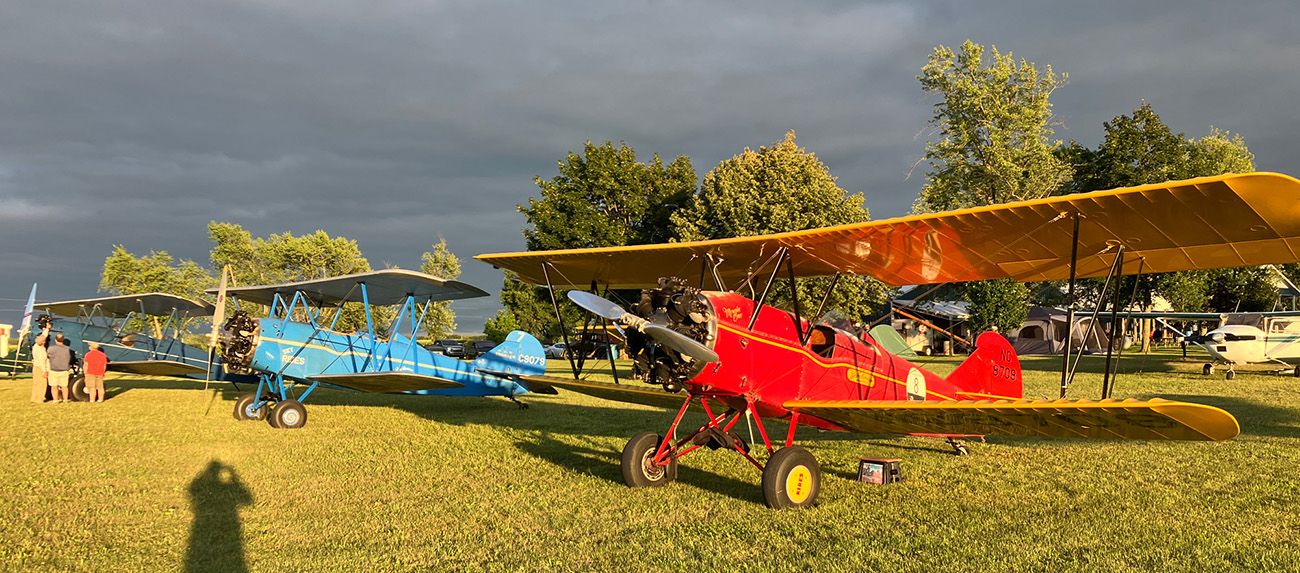
Airventure 2025 | Day 2
July 17 | Yesterday I lucked out by getting the crew car to go to a hotel. I checked online and saw ads for $60 to $140 a night for a room, so I went down to the Holiday Inn Express and was shocked that the rate was actually over $250 a night.
The desk clerk explained that the online rates are from third parties that book ahead. If I wanted a room in August, I could get the lower rate online. The rest of the regular chains had the same rates, so I found a nice local place for $95 a night, breakfast included.
Feeling much refreshed in the morning after a good night’s sleep, I had a waffle and cup of coffee, got to the airport before 7, pre-flighted the airplane, and was in the air by 7:30. Density altitude was above 7,000, so it was a slow climb out to altitude for my next leg.
The Rockies over Wyoming are pretty desolate. Rawlins is in Carbon County, indicative of the extraction economy of that state. As I crossed the last ridge before the land sloped down to the Mississippi Basin, I looked out on a white, fluffy sea of cloud. I was at 11,000 feet and the view below was of undulating ridges of cloud, interspersed with breaks to the south.
I knew from my preflight briefing that there was a few thousand feet above the ground to the ceilings, so I knew that I could break out and find a place to land in an emergency, but I’m not as relaxed flying over cloud as I am when I can see the ground.
I usually make my next refueling stop at Yankton, South Dakota, because the airport and the local EAA chapter have a hot lunch in warming trays waiting. I goy my hot dog and pork and beans and sat down with a pilot flying a Rans and a couple people from the airport.
The Rans pilot had just mowed his hay, and showed us pictures and a video of his crop and machine. The Rans pilot mentioned that he cut the hay into winrows. The other people there perked up, looking at him. “What do you call them?” they asked. “Winrows”, he replied. There ensued about a ten-minute discussion about whether you call them winrows or swaths. You never know what you are going to learn over a hot dog and beans in the midwwest.
The rest of the flight was as smooth as the first leg, with the overcast thinning into broken and the scattered clouds, with only a few wisps above me. As I got closer to Brodhead, the clouds closed in again, with them going from broken to overcast. I started my descent through the clouds and broke out at about 3,500 feet, about 2,000 feet above ground. I bumped along thee last 220 miles, then crossed over Monroe Municipal airport and saw Brodhead 10 miles ahead.
The airport is always challenging for me to find, since it is green, surrounded by green, with trees screening the field. I saw the hangars in the distance, circled the airport to check the wind (thanks, Pilatus pilots everywhere), and descended into a left downwind for runway 9.
Landing on grass is always a treat. I hold just a little power on with the yoke all the way back until I’m on the grass and settled down. I taxied to the camping area next to the hangars, shut down, and just sat there for a minute letting it sink in that I was back again to Brodhead.
What a lovely place.
- Hits: 306